Fig. 1. Position of the Ertil test polygon for monitoring carbon pools in agroecosystems in the GoogleEarth image
Employees of the Federal Research Center "V.V. Dokuchaev Soil Science Institute" have completed the creation of the "Ertil" Test polygon in the Voronezh Region
From August 1 to 8, 2024, employees of the Federal Research Center "V.V. Dokuchaev Soil Science Institute" conducted the first stage of work on establishing a new test polygon "Ertil" in the Ertilsky district of the Voronezh region (Fig. 1). The site is located on the Oka-Don lowland plain, with soil-forming rocks represented by loess-like loams, underlain at a shallow depth (1.5-2m) by the Dnieper moraine.
The polygon allows assessing the role of soil-protective agricultural technologies using No-Till and Strip-Till in various combinations with undersowing of cover crops compared to traditional soil tillage in the aspect of carbon sequestration in the soil. You can read about the reconnaissance of the test site here.
The farm LLC "Niva", on whose fields the polygon is located, alternates No-Till and Strip-till technologies from year to year depending on the crops grown. In August, one of the 2 clusters of the site was established, consisting of 3 plots in fields with cover crops after harvesting winter wheat using No-Till technology.
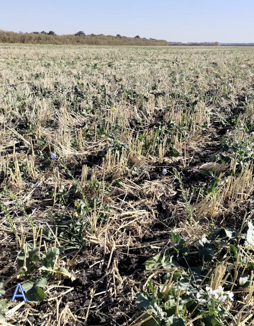
Cover crops are represented by radish, turnip rape, and flax (Fig. 2A). Two of the plots are located on typical chernozems in combination with leached chernozems within the plot. It is worth noting that these locations are characterized by patchy occurrences of leached and typical chernozems on convex positions of the mesorelief. The third plot was established on meadow-chernozem soil in the bottoms of saucer-shaped depressions (Fig. 2B).
Fig. 2. A – Cover crop sown after winter wheat harvest. Flax, radish, turnip rape. B – Meadow-chernozem soil of the Ertil polygon. The marks indicate the boundary of the appearance of effervescence from 10% HCl, marking the upper boundary of the appearance of inorganic carbon in the form of carbonates.
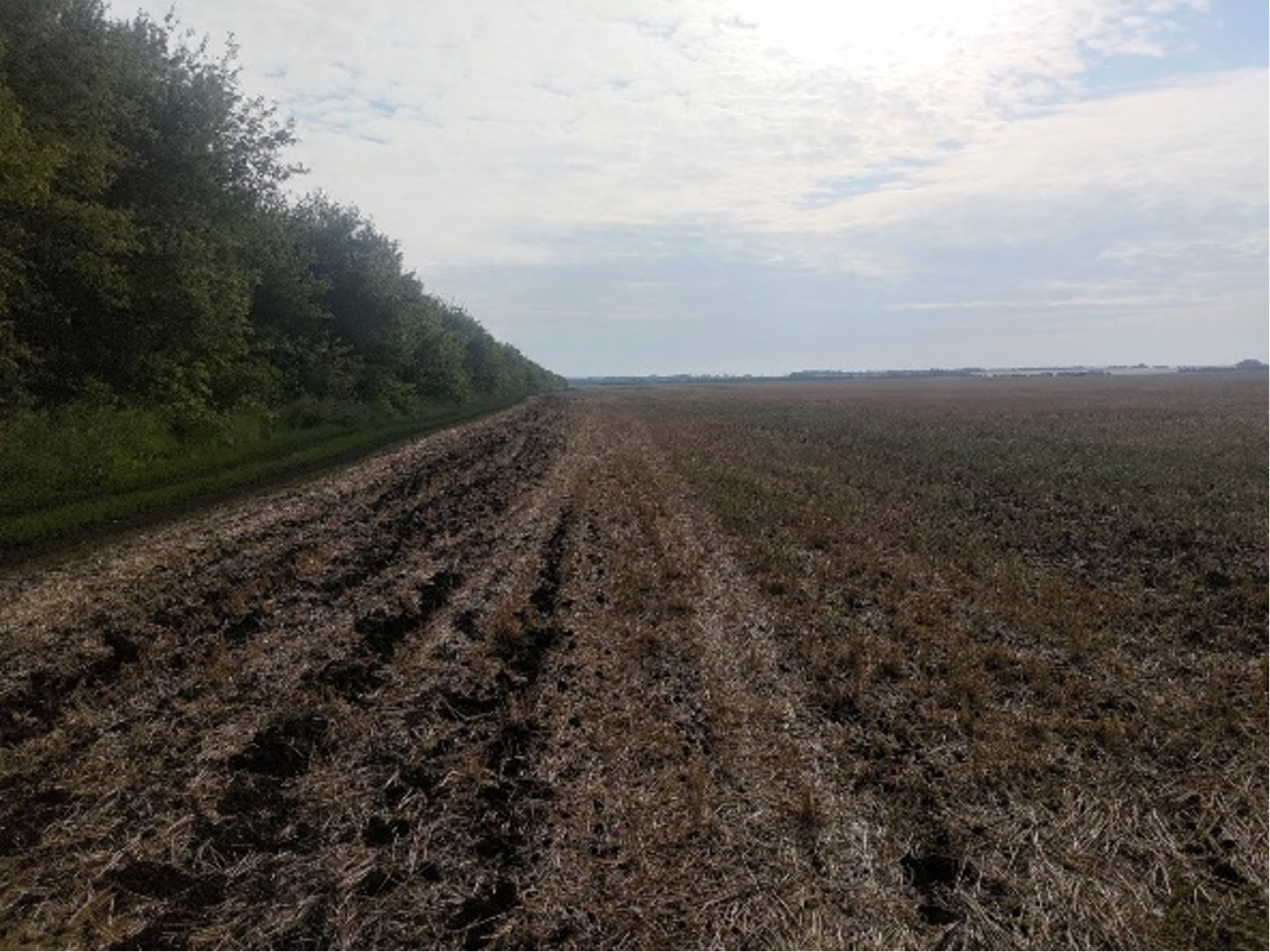
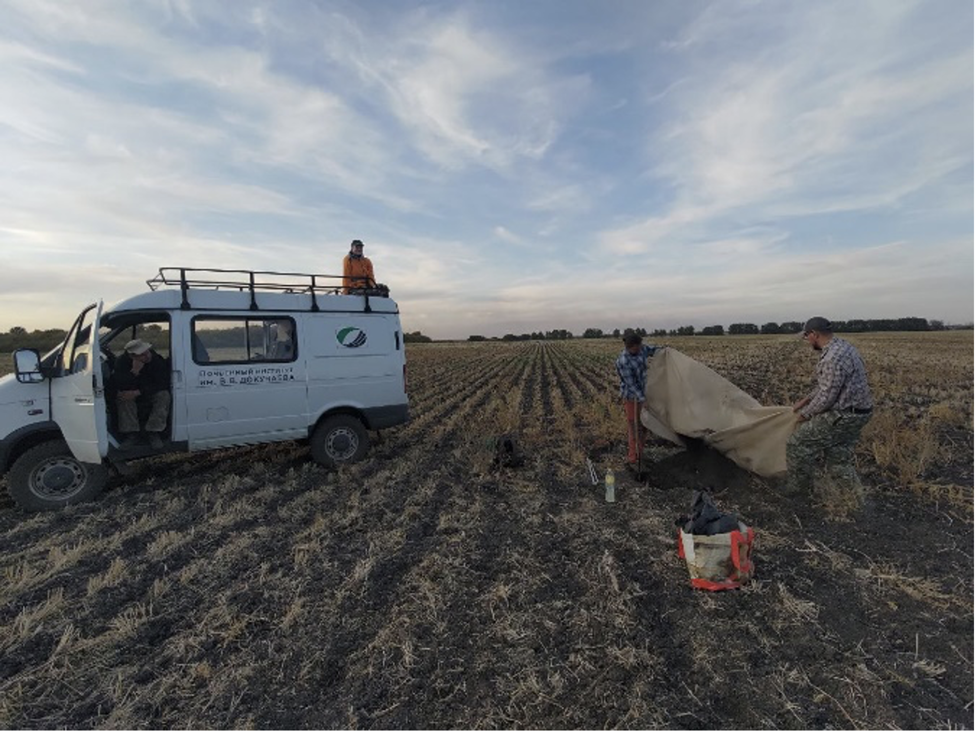
On each of the plots, samples were taken for density with 5-fold replication from a profile in the center of the plot (Fig. 3), samples for organic and inorganic carbon were taken in the central profile to a depth of 2.5, and a drill was used to collect samples from 8 points - replications using the "cross" method around the profile at short distances (the plot as a whole occupies 30*30 m). A feature of working in fields with No-Till technology is the mandatory placement of soil dumps on a film to minimize the impact on the monitoring site (Fig. 4).
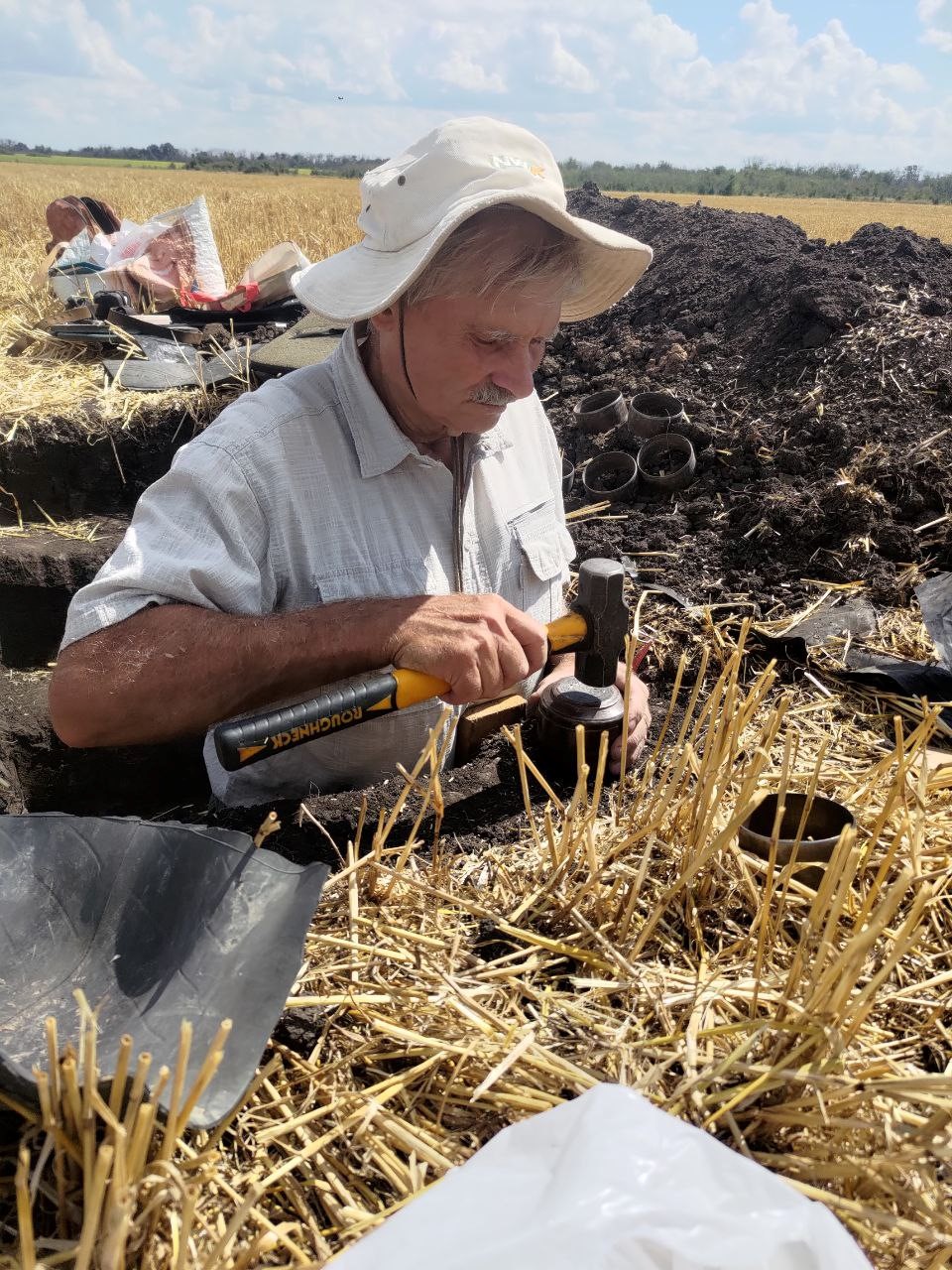
Fig. 3. N.B. Khitrov takes density samples from the central profile of the plot.
Fig. 4. On the left - Agrolandscapes of the Ertil site, on the right - the process of laying a site in a field with No-Till. It is imperative to place the dumps on a film to minimize the impact on both the monitoring site
From September 30 to October 7, the final stage of work on establishing the second cluster of the carbon pools and fluxes monitoring site was carried out. The working group included 7 people, including the driver of the "Sobol", as well as representatives of the departments of Genesis and reclamation of saline and solonetzic soils, and the department of Physics, hydrology and soil erosion of the FRC V.V. Dokuchaev Soil Science Institute (Fig. 5).
Fig. 5. The final stage of work on establishing the "Ertil" site.
The task facing the employees was to create the second cluster of the site on row crops under traditional soil tillage with moldboard plowing combined with irrigation (Fig. 6), as well as supplement the first cluster on No-Till technology with soil survey and an additional test site. For the creation of the second cluster on traditional soil tillage, a field with harvested corn was taken, on which 2 test sites were established and a soil survey was carried out to substantiate typical conditions at the locations of the monitoring sites.

Fig. 6. Typical plowed irrigated chernozem (left) and T-L Irrigation circular sprinkler machine (right).
The "Ertil" polygon was created in 2024 and consists of 2 clusters, including 6 test plots (Fig. 7).
By 2030, the Federal Research Center "V.V. Dokuchaev Soil Science Institute" will increase the number of carbon pool monitoring polygons to 50. Employees of the Federal Research Center "V.V. Dokuchaev Soil Science Institute" are participants in the Soil Group of the "RITM of Carbon" consortium in working on the project "Russian Climate Monitoring System" (a major innovative project of state importance, KIP NI, supervised by the Ministry of Economic Development of the Russian Federation).
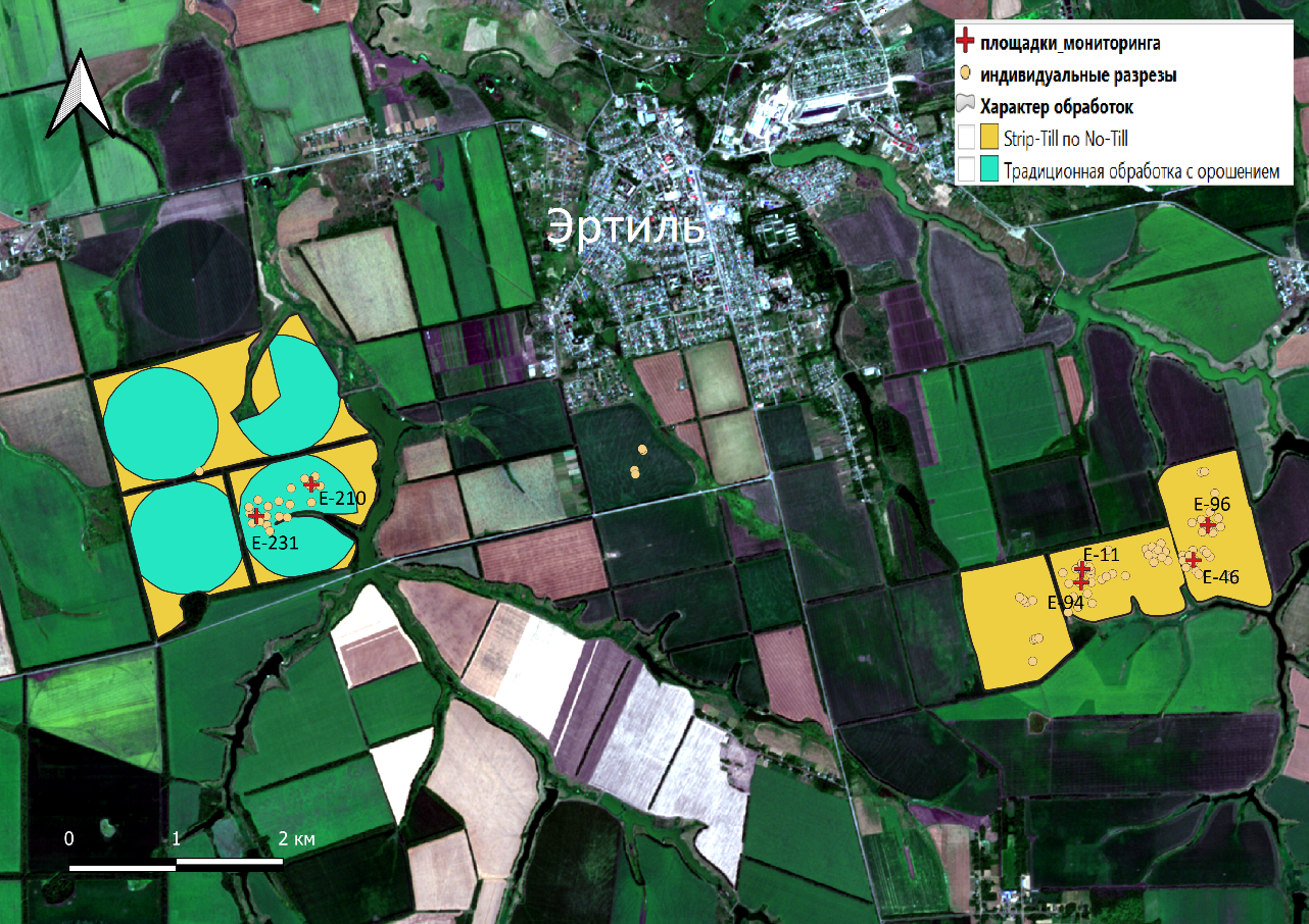
Fig. 7. Diagram of the location of test sites and individual pits of the "Ertil" polygon.


